Simulation of Land Use and Land Cover Changes [LULCC] is been made by workpackage 4 of ALICE, related to the improvement of biodiversity characterisation using remote sensing. These simulations aim to detect how Blue and Green Infrastructure Networks influence ecological and biogeochemical processes.
The use of drone data allow us to estimate spacial distribution of habitat, an essential descriptor to monitor and manage natural or semi-natural ecosystems.
Thomas Houet
“Habitats integrate both the environmental conditions and the related biodiversity. However, it remains challenging to map certain habitats such as inland wetlands due to spectral, spatial and temporal variability in the vegetation cover.”
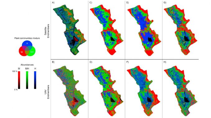
The team from CNRS and Université of Rennes 1 designed an approach that combines satellite and unmanned aerial vehicle (UAV) data to exceed their respective limitations.
“This study shows innovative results and perspectives: while UAV can improve habitat discrimination, results vary among acquisition periods and habitats. Results illustrate well the great potential of combined UAV and satellite data but also demonstrate the influence of endmembers on the unmixing process and technical limitations (e.g. spectral mismatches between sensors), which can be overcome using domain adaptation.”
Access the science article here: Can UAVs fill the gap between in situ surveys and satellites for habitat mapping?
